
Ancient South Crete: The Forgotten Archaeology Beyond Knossos
How a British archaeologist uncovered the hidden ancient landscapes of Agia Galini, Agios Ioannis, Triopetra and the South Coast
In 1865, a British naval officer named Captain Thomas Abel Brimage Spratt published two volumes of travels through Crete that remain, a hundred and sixty years later, among the most readable accounts of the island ever written. Spratt had mapped the coastline, climbed the mountains, examined the ruins, and asked the locals what they knew. His conclusion about the province of Agios Vasilios — the region that runs from the valley below Spili down to the south coast between Plakias and Agia Galini — was unequivocal and, in retrospect, rather magnificent in its wrongness.
"It is a singular fact," Spratt wrote, "that throughout its whole extent not any ancient city has been discovered; and yet there can be no doubt that in one or two of the most populous of these valleys there must have been a town of more or less importance. To all my inquiries, however, in my two journeys through the greater part of the province, I could learn of no ruins or traditional site of any Hellenic city... Notwithstanding this denial, I am induced to call the attention of any future traveller to this absence of any recognized ancient site in so large a district."
A hundred years later, two British archaeologists accepted the invitation.
Hood and Warren in the province
Sinclair Hood is best known in the archaeological world as the director of British School excavations at Knossos during the 1950s — one of the most significant sustained investigations of the Minoan palace since Arthur Evans. But after years working at the island's most famous site, Hood became increasingly interested in something different: not the centres of power but the landscapes surrounding them. The places where ordinary people had lived, hidden, farmed, and traded. The archaeology of the margins rather than the palaces.
In May 1965, Hood travelled through the province of Agios Vasilios with his colleague Peter Warren, accompanied by Mrs. Hood and, later, a Mr. John Falconer. They spent ten days moving through remote valleys, coastal cliffs, mountain villages and isolated beaches, noting pottery scatters, examining wall traces, and visiting sites that had been mentioned in passing by earlier scholars without ever being properly documented. Their findings were published in the Annual of the British School at Athens as "Ancient Sites in the Province of Ayios Vasilios, Crete" — a paper that remains, for anyone interested in the deeper history of this corner of the island, essential reading.
What makes it extraordinary is not simply what they found. It is how they found it: on foot, by following local knowledge, by asking in villages, by scrambling up hillsides on the advice of farmers who had noticed old walls in their fields or sherds turning up when they ploughed. The paper reads less like an excavation report and more like the field diary of two men genuinely excited by what the landscape was telling them — cautious in their conclusions, honest about uncertainty, and alive to the particular pleasure of finding something in a place where, officially, nothing was supposed to exist.
Spratt, it turned out, had been asking the wrong questions in the wrong places.
A landscape that was never empty
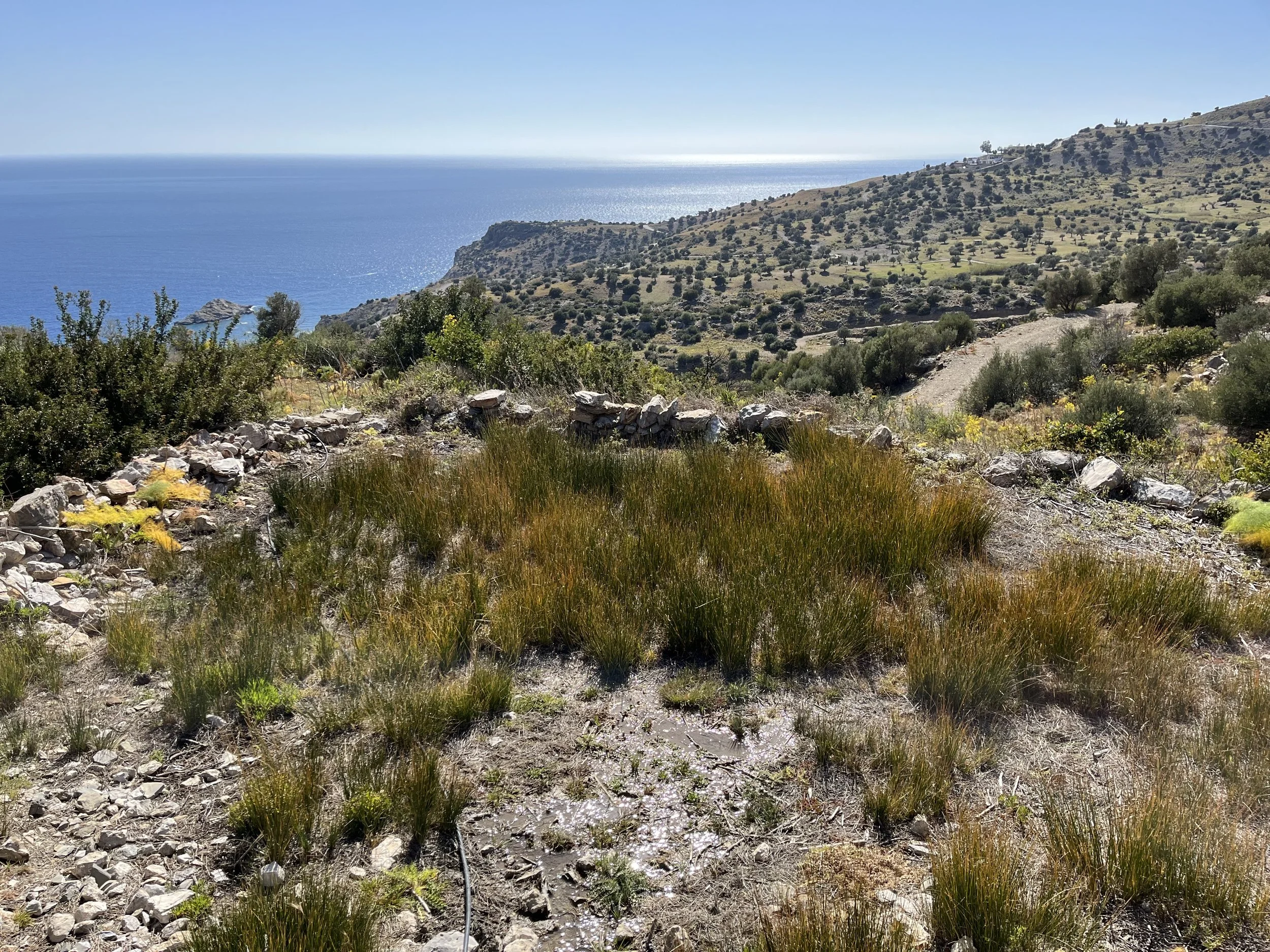
The province Hood and Warren surveyed runs roughly from Spili in the north to the coast, and from the Plakias area in the west to Agia Galini and the Messara plain in the east. It is divided by mountain barriers into distinct coastal zones — the area around Plakias and Myrthios, the mountain-enclosed bay around Kerame, and the plain below Melambes and Saktouria stretching down to Cape Melissa and Triopetra — each separated from the others by long stretches of rocky shore and forbidding cliff where, as Hood noted, the only possible harbours must be sought in widely separated coastal valleys.
This geography shaped everything. The coastal landing places, however imperfect, were of disproportionate importance for ancient ships navigating a dangerous coastline. Tiny hamlets at the mouths of gorges, sheltered coves that could hold a few vessels, rocky headlands with freshwater springs — all of these mattered enormously to a Bronze Age maritime world. And many of the place names recorded by ancient geographers and pilots, Hood suggested, may have been exactly these: the names of landing places rather than cities, preserved because sailors needed to know them.
What Hood and Warren documented across thirty-six sites was a landscape of continuous, layered habitation stretching from the Neolithic period through the Minoan, post-palatial, Archaic, Classical, Hellenistic, Roman, Byzantine, and Medieval periods. Not spectacularly. Not with palaces or monumental architecture. But persistently, stubbornly, across millennia — pottery scatters on hillsides, walls emerging from olive groves, cemeteries on knolls above valleys, sanctuaries in gorge caves. The province of Agios Vasilios had not been empty. It had simply been overlooked.
Agia Galini and the city of Eremopolis
The village of Agia Galini is today associated with harbour cafés, fishing boats and whitewashed alleys descending to the Libyan Sea. But Hood's account opens a very different historical window onto the same location.
The modern village, Hood established, only began to be settled in the latter part of the nineteenth century. Before that, the little valley where it now stands was known as 'Eremopolis' — the deserted city. In 1896, the Italian archaeologist Halbherr wrote that inhabitants of the neighbouring mountain villages, wishing to make use of an ancient landing place, had begun to build dwellings and storehouses "in that deserted spot until then known as Eremopolis." The new village was named Agia Galini after an old church on a hill to the north-east.
What had been there before? The remains Halbherr and subsequent visitors described were essentially those of a sanctuary of Artemis — an aqueduct, columns of Egyptian granite flanking the gate of the church of the Tessares Martires, and traces of what may have been a Roman quay or sea-wall running toward the harbour. The two granite columns still standing in the village today, repurposed into the fabric of a church, are among the longest continuous threads of human occupation in a place that otherwise wears its history lightly.
The ancient city of Soulia — mentioned in historical sources and connected to the south coast by scholars since the nineteenth century — may have stood nearby. Pashley had suggested it in 1837. Halbherr first located it in the little valley about half a kilometre west of the river Platis, where the modern village now stands. Hood revisited the question cautiously, noting a scatter of sherds and traces of ancient house walls on a hill above the church of Panayia to the north-east of the village, and the fragments of what may have been an early Christian basilica among the graves there. He did not claim a definitive identification. But the logic of the place — a naturally protected harbour beneath defensive hills, with inland routes connecting directly toward the Messara plain and broad visibility over the Libyan Sea — was precisely the logic that ancient settlements followed again and again on this coast.
There is also an ancient wreck lying in four to five metres of water near Cape Kakoskalo, about three-quarters of an hour by boat from Agia Galini. First reported in 1937, it was investigated with the help of the Greek navy in 1960, yielding a remarkable collection of bronze statuettes, coins, lamps, signet rings, bells, and tools — objects ranging from the time of Augustus to the third century AD. Local tradition in Agia Galini held that the cargo had belonged to a corsair ship carrying antiquities plundered from Gortyna and Phaistos. Whatever its origin, a bronze hoard lying on the seabed a short boat trip from the modern harbour is not a bad emblem for the archaeological density of this apparently ordinary coastline. Parts of the treasure can today be found in the Archaeological Museum in Rethymno.

The Mother Goddess of Saktouria
Further east along the coast, in the wide valley stretching down toward Cape Melissa and the area of Triopetra, Hood and Warren visited the site known as Ayios Ioannis, below the village of Saktouria.
The site is remote even by the standards of South Crete. The roads narrow. The landscape becomes rougher. A medieval church of Ayios Ioannis stands among olive trees on a southward-facing slope above the sea, and around it, scattered thinly along the slope for some fifty metres above and below the church, are the traces of a Minoan settlement — sherds, pithos rims, traces of house walls and terracing. The pottery Hood identified placed the site in the Middle and Late Minoan periods, earlier in character than the refuge settlements of the post-palatial period found elsewhere in the province.
What the site is best known for — though few visitors to the nearby beaches of Triopetra and Agios Pavlos are aware of it — is a discovery made not during the 1965 survey but some years earlier, described to Hood by their guide Demetrios Tsangarakis. In 1947, Tsangarakis had found in a bank in his well-watered garden on the north-east edge of the settlement area, about fifty metres above the church, a large Minoan clay idol: a goddess figure with raised hands, of the type that archaeologists associate with the Late Minoan III period. It is now displayed in the Archaeological Museum of Rethymno.
Standing before that figure in the museum — or simply knowing it exists — changes something about the experience of the landscape around Triopetra and Agios Pavlos. The beaches that visitors come to for their sand and their swimming were once a settled Minoan world, with its own spiritual life, its own ceramic traditions, its own goddess standing in a terraced garden above the sea. The silence of those hillsides today is a recent thing. The goddess predates the silence by three and a half thousand years.
Kerame and the fortified city
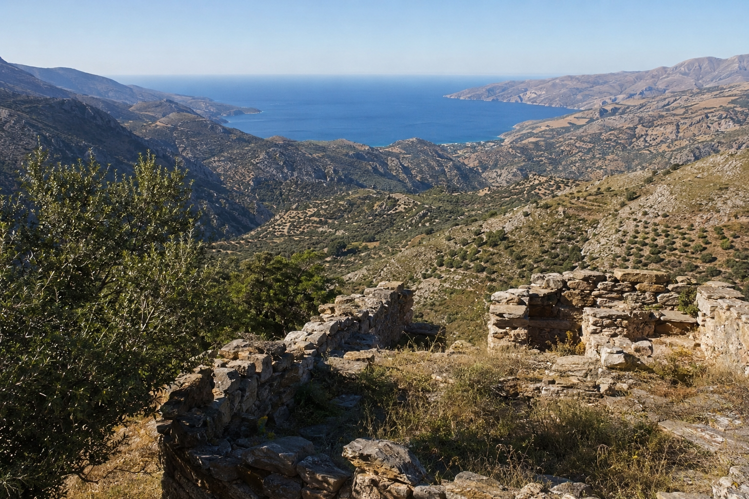
Among the most substantial discoveries in Hood and Warren's survey are the ruins above the modern village of Kerame — a site that Hood identified as probably the ancient city of Bionnos, first recognised by a local man named Pappadakis in 1915 and since then largely ignored by the wider archaeological world.
What must have been a relatively important Greek city stands on high ground overlooking the sea between two stream beds, about two kilometres below the village. The city covered the hill known as 'Pirgos' and the slopes below it. Scattered sherds and abundant stones from house walls spread over an area of about a hundred and fifty metres from east to west. More striking than the extent is the evidence of fortification: a curtain wall, built of rough polygonal dry-stone masonry, running straight from east to west for over a hundred metres along the northern or landward side of the city, with two semicircular towers or bastions projecting from it, each roughly six to seven metres in diameter. At the eastern end, a rectangular corner tower of squared blocks overlooks the valley and the stream bed that bounded the city on that side.
An inscription from the site, assigned to the late fourth century BCE, records a treaty between this city and a neighbour — which implies that it was then an independent state. The harbour, presumably used for small boats, would have been at the stream mouth by the shore, though Hood noted that former harbours in the western part of Crete may have been obliterated by the rising of the land since Roman times.
Hood also noted, among the pottery recovered from the site, a clay stamp depicting Europa and the bull — a Hellenistic image found in the fields of Kerame, in a fortified city overlooking the Libyan Sea, on a coastline whose mythology, as we explore elsewhere in the Journal, has been connected to Europa's arrival in Crete since antiquity.
The refuge settlements
One pattern that emerges repeatedly from Hood and Warren's survey, and that reveals something important about the deeper history of South Crete, is the appearance of settlements in what archaeologists call 'refuge' positions: high, steep, difficult of access, hidden from direct maritime attack.
The most significant of these in the province is the site at Atsipadhes 'Fonises', an extensive Late Minoan III settlement high on the side of Mount Kouroupa, about three-quarters of a kilometre south-east of the village. Traces of occupation with pottery and stones from house walls cover the steep terraced northern slopes below a rocky peak for a distance of a hundred and fifty metres or more. On the summit, a small flat area of about ten metres square may have been the site of a shrine. The settlement enjoys an extensive view over the whole valley of Agios Vasilios as far as Spili and beyond, with the entrance to the Gorge of Preveli to the south and the pass to the north coast road toward Rethymno visible in the distance. Hood suggested this may have been the chief refuge settlement of the Late Minoan III period at this end of the valley.
The Late Minoan III period — roughly 1300 to 1100 BCE — is the period of the post-palatial collapse, when the great Minoan palace centres had already fallen and populations across the island were reorganising themselves into smaller, more defensible communities. But Hood also connected several of the elevated and isolated sites in the province to the later Arab conquest of Crete around 825 AD and the coastal insecurity it produced. When the sea became dangerous, people moved upward. The geography of refuge, in other words, was not a Minoan invention but a recurring response to recurring instability — one that shaped the landscape of South Crete across centuries and that still, Hood suggested, partially explains why the villages of this region feel hidden rather than exposed, emerging from mountain folds rather than advertising themselves to the sea.
The cave of Hermes Kranaios near Patsos adds a further dimension. The gorge of Patsos, outside the village of the same name toward the western end of the province, contains a cave with a small church of Ayios Antonios built into its north side. Objects from this cave — excavated by local peasants in the 1880s and acquired by the Italian archaeologist Halbherr, and later by Arthur Evans himself in 1894, whose purchases are now in the Ashmolean Museum in Oxford — span a remarkable range: Minoan period through the Geometric, Archaic, Hellenistic, and Roman, with a near-continuous thread of cult activity stretching across two thousand years. Sanctuaries in inaccessible gorges, maintained through every period of instability and change, are as characteristic of this landscape as the refuge settlements on the ridges above.
What Hood and Warren established
The paper's significance lies not in any single dramatic discovery but in its cumulative demonstration of something Captain Spratt had missed entirely: that the province of Agios Vasilios had been continuously inhabited, strategically positioned, and culturally active from the Neolithic period onwards. The absence of monumental ruins was not evidence of emptiness but evidence of a different kind of human occupation — dispersed, adaptive, maritime in orientation, shaped by the geography of a coastline that offered few easy harbours and many reasons for caution.
The ancient names Hood tentatively connected to these sites — Soulia at Agia Galini, Korion at Melambes, Psykheion at Cape Melissa, Bionnos at Kerame, Phoinix near Plakias — are all marked with question marks in the paper. Hood was too good a scholar to claim certainties the evidence wouldn't support. But the landscape he mapped, the pottery he collected, and the settlement patterns he traced across thirty-six sites across ten days in May 1965 permanently altered the understanding of what South Crete had been.
Reading the paper today, the most striking quality is its relationship to the landscape that visitors still move through. The hill above Agia Galini where Hood found sherds and ancient wall traces is still there, above the village. The slope at Ayios Ioannis where Tsangarakis found the goddess is still planted with olive trees above the chapel. The walls at Kerame still stand in the fields below the village. The cave of Hermes at Patsos still has its spring and its church.
The archaeology of South Crete is not behind glass. It is in the terrain.
Hood and Warren's paper was published as "Ancient Sites in the Province of Ayios Vasilios, Crete" in the Annual of the British School at Athens, Volume 61 (1966), pp. 163–191. The Mother Goddess from Saktouria is displayed in the Archaeological Museum of Rethymno. The objects Evans purchased from the cave of Hermes Kranaios at Patsos in 1894 are held in the Ashmolean Museum, Oxford.
For the mythological landscape of South Crete — including the ancient traditions connected to Agia Galini, Kommos, and the Paximadia Islands — see the STAYS Journal's companion piece on the forgotten myths of South Crete. For the Minoan palace that controlled the trade routes Hood was tracing, see our guide to the Palace of Phaistos. And for the beach above which the goddess of Saktouria once stood, see our Triopetra beach guide.
The STAYS Home Collection includes properties in and around several of the landscapes described in this article — above Triopetra and Agios Pavlos, near Agia Galini, and in the hills above Plakias — each positioned within a terrain that, as Hood and Warren established, has been inhabited and valued for considerably longer than most visitors realise.